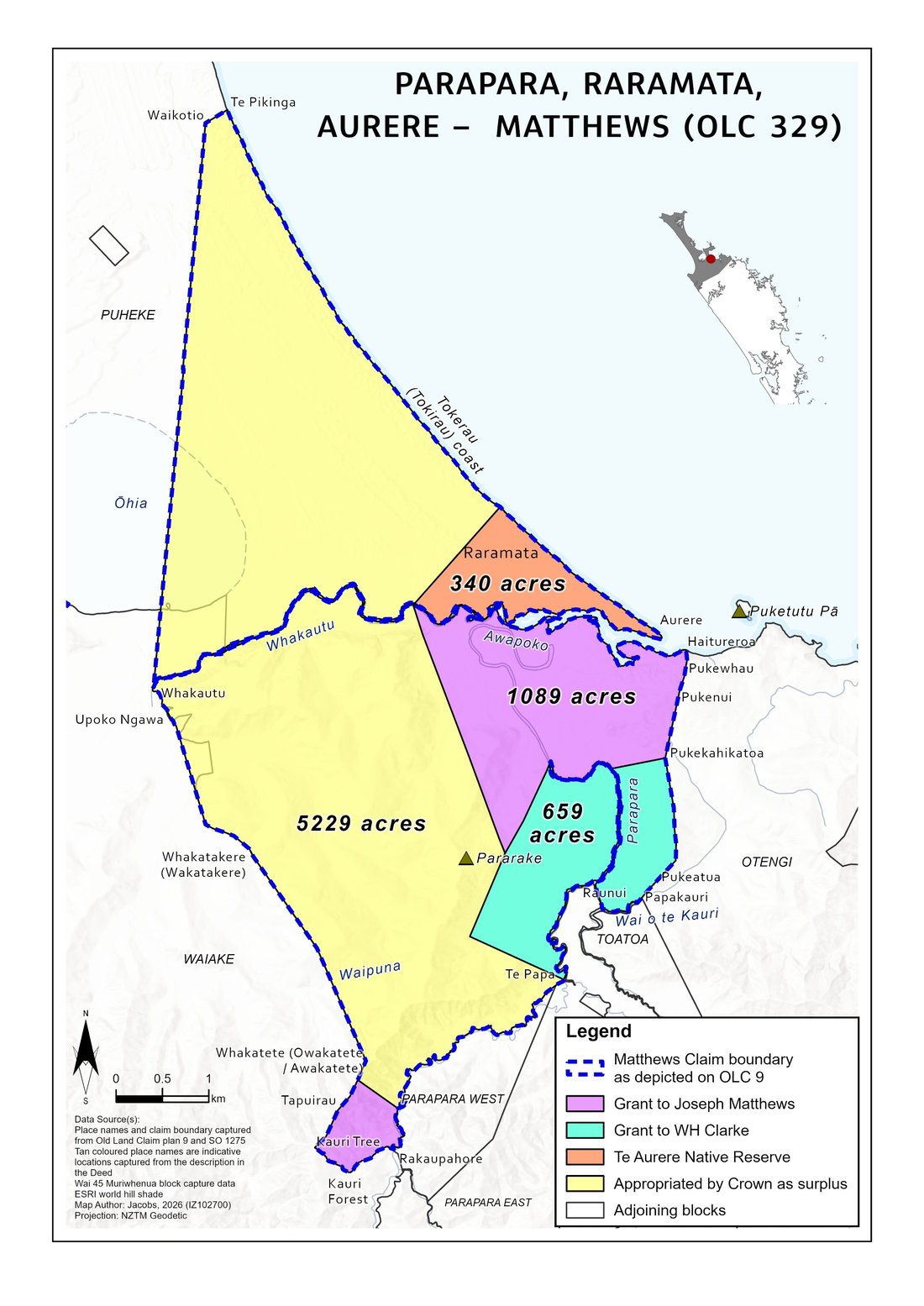
The Matthews claim at Parapara, Raramata and Aurere — where the 7,317 acres actually went. Source: Jacobs, 2026, from Old Land Claim plan 9 and SO 1275.
Everything about where our claim stands, and where it's heading — built for anyone connected to Wai 2000, especially the mokopuna growing up after it began. Read the full story, see what the research has found, or search the actual reports for your tupuna's name, word for word.
Named in our pepeha, and the original Parapara Marae wharenui was named for it. When the Crown negotiated the Otengi (1858) and Toatoa (1865) blocks, the maunga was simply used as a boundary marker — splitting it in two. Only a small southern portion remains Māori land today.
Sources: Raniera Bassett, Brief of Evidence, 22 August 2012 · Leonard, Volume I →
Chappy Harrison lodged Wai 2000 with the Waitangi Tribunal on 28 August 2008, with the Parapara Marae Committee's support. It has since grown to eight named claimants, and is heard within the wider Wai 45 Renewed Muriwhenua Land Inquiry.
From why the claim was lodged, through the research commissioned since, to where things stand today — the complete timeline of the claim itself lives on its own page.
Decades of promises made, and promises broken. Two of the key findings from the research behind our claim.
Missionary Joseph Matthews promised the Crown would leave Pararake with Ngāti Tara. An 1858 map even labelled it "Native Reserve Hill." No reserve was ever legally made — and in 1906, part of the summit was turned into a Crown quarry.
An urupā and a 96-acre cultivation block were both shown on official survey plans as set aside for Ngāti Tara. Neither was ever formally reserved — the urupā's boundary dispute remains unresolved today.
Search directly across the actual research reports — a name, a place, a block — and see the real passages, word for word, with the source and page number. No AI, no summarising, just what's actually written.
Two more places worth knowing about: the FAQ answers the questions whānau ask most — what Wai 2000 actually is, how the Tribunal process works, how to request access to the full reports. Resources lists the research reports themselves, meeting minutes, and background reading on the claims process in general.